The Mt Pinatubo Hike
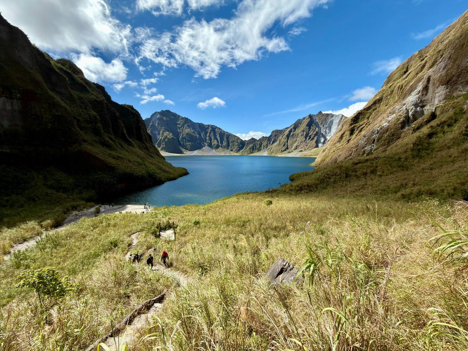
A Mt Pinatubo hike takes you into the crater of the volcano behind the second-largest eruption of the 20th century. On June 15, 1991, Pinatubo blew out so much rock that its summit collapsed into a caldera about 2.5 kilometers wide (USGS fact sheet). Rain has since filled it with a blue-green crater lake, and getting there means a bumpy 4x4 ride across grey lahar fields followed by a walk up a river canyon carved through volcanic ash.
It is a day trip from Capas, Tarlac, with an assigned jeep and a local guide, and it suits most reasonably fit travelers. If you enjoy it, add more mountains from our trekking guide or chase a sunrise on a sea of clouds hike.
Mt Pinatubo Routes
Capas Route, Tarlac
The standard day trip: register in Santa Juliana, ride a 4x4 through Crow Valley, then hike the O’Donnell riverbed to the crater lake.
Inararo Route, Pampanga
A tougher route from Porac near Clark, past Ana-An Falls to a viewpoint on the summit ridge. It does not cross military land.
Botolan Route, Zambales
The west-side approach from Botolan is a multi-day trek and is only offered occasionally. Most visitors use the Capas route.

Best Time to Hike Mt Pinatubo
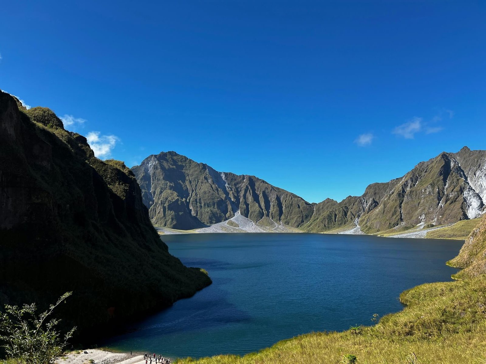
Plan your Mt Pinatubo trek for the dry season, roughly December to May. January to March usually brings the clearest skies and the bluest lake, while April and May get very hot in the shadeless canyon (season notes).
From June to November the southwest monsoon brings heavy rain, and PHIVOLCS can issue lahar warnings for the river channels around the volcano. Tours do not start in bad weather, so keep a spare day. Crow Valley is also an Air Force training area, and access can close on some days during military exercises, usually around April and May. Check with your operator before you travel.
Mt Pinatubo Trekking Tips
Book through an accredited operator or the Capas tourism office. Foreign nationals need a Philippine Air Force visit clearance for the Capas route, which crosses Crow Valley; the operator Pinatubo Mountainero says passport details must be sent about 35 days before your visit (foreigner requirements). Bring your passport on the day.
Wear sturdy shoes that can get wet, a hat and sunscreen, and carry at least 1.5 liters of water. A buff or mask helps on the dusty jeep ride. Older hikers may be asked for a blood-pressure check or medical certificate at registration, so ask your operator what applies to you.

The Mt Pinatubo Crater Lake
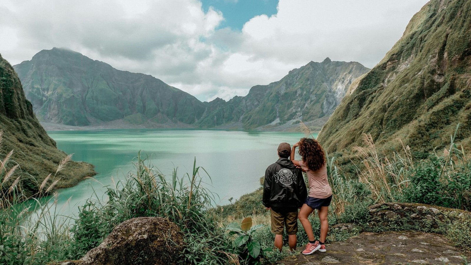
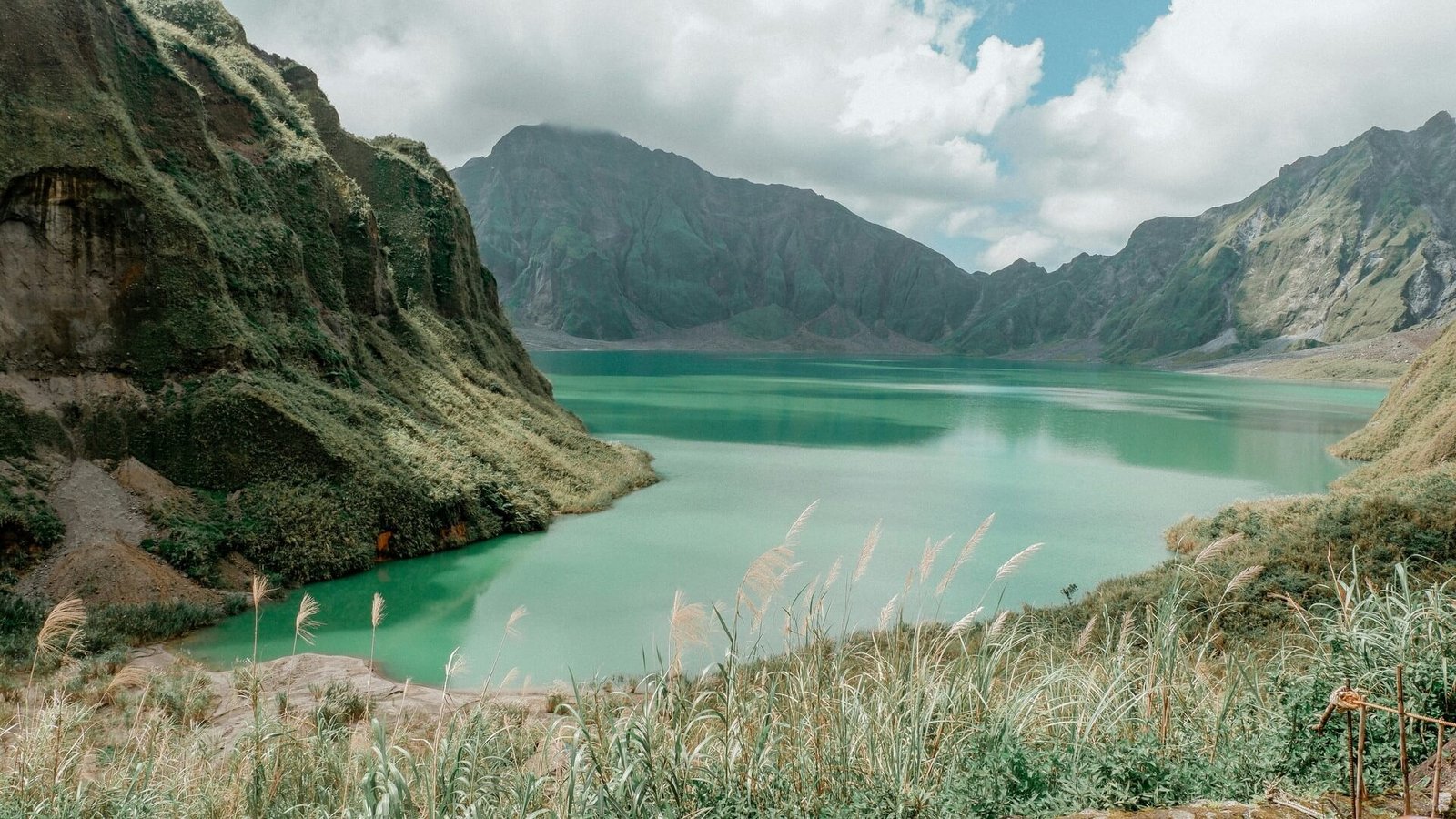
The lake sits where the old summit used to be, ringed by steep caldera walls streaked with ash. Walk down to the shore viewpoint, find a shady spot and take it in, but do not swim. After a visitor drowned in January 2013, the Department of Tourism warned that PHIVOLCS had found arsenic, aluminum, boron and other hazardous substances in the water, and that rockfalls and landslides make the shore risky in heavy rain (Philstar report).
Volcanically, Pinatubo is quiet: PHIVOLCS has kept it at Alert Level 0 since August 2021, meaning no eruption is expected in the foreseeable future (HazardHunterPH). The bigger day-to-day hazard is water, so always follow your guide if they decide to turn back.
How to Get There
The Capas route starts at the municipal tourism office in Barangay Santa Juliana, Capas, Tarlac. From Metro Manila it is about 2.5 to 3 hours by road via NLEX and SCTEX, and roughly an hour from Clark or Angeles City (route details). Without a car, take a bus bound for Tarlac or northern Luzon to Capas, then a tricycle to Santa Juliana.
Registration starts before dawn, so most people either sleep in Santa Juliana or Capas the night before, or book a Mt Pinatubo tour from Manila or Clark with an early-morning pick-up. Private cars cannot drive into Crow Valley; from Santa Juliana you continue only in the assigned 4x4. The Capas trail reopened on June 23, 2025, after a two-month suspension, with new rules agreed with local Aeta communities (TripZilla).
What to Expect
So how long is the Mt Pinatubo hike? Expect about an hour each way in the 4x4, then roughly 1.5 to 2 hours on foot each way along the riverbed, with a few shallow stream crossings and a short, steeper climb at the end. In the dry season the jeeps can drive farther in, which shortens the walk. Most groups are back in Santa Juliana by early afternoon (trek overview).
Typical day
- Pre-dawn registration and briefing at the Santa Juliana tourism office.
- Jeep ride through the lahar canyons of Crow Valley.
- Hike up the O’Donnell River to the crater lake viewpoint.
- Rest and lunch by the lake, then the same way back.
What to bring
- Shoes that grip on wet rock, plus a change of clothes and footwear for the ride back.
- Water, snacks or a packed lunch, sunglasses and a rain jacket.
- Enough cash for fees and extras, as there are few facilities near the trailhead.
Responsible Travel Tips
- Book only with accredited operators so fees reach the local communities who manage the trail.
- Respect the Aeta, whose ancestral lands surround the volcano. Ask before taking photos of people.
- Stay out of the lake and away from the foot of the crater walls.
- Carry out all your trash, including food wrappers and plastic bottles.
- Keep to the trail and leave rocks, ash formations and plants as you found them.
- Do not push on in heavy rain; turn back when your guide says so.
Frequently Asked Questions
How long is the Mt Pinatubo hike?
Usually about 1.5 to 2 hours on foot each way after a one-hour 4x4 ride, so plan for most of the day.
Is the Mt Pinatubo trek difficult?
It is mostly flat and easy underfoot, but long, hot and without shade. Beginners with average fitness usually manage it.
Can you swim in the Mt Pinatubo crater lake?
No. Swimming is not allowed because of hazardous substances in the water and the risk of rockfalls near the shore.
Do foreigners need a permit?
Yes, for the Capas route foreign nationals need a Philippine Air Force visit clearance arranged in advance through an operator or the tourism office.
Can I do it as a day trip from Manila?
Yes. Many tours pick up in Manila in the early hours, though staying in Capas or Clark the night before makes for an easier morning.
Is Mt Pinatubo safe to visit?
PHIVOLCS keeps it at Alert Level 0, but heavy rain can make the riverbed dangerous, so trips are cancelled in bad weather.
Read next: Trekking in the Philippines, Sea of Clouds Hike, Banaue and Batad Rice Terraces and our Manila travel guide.